|
|
|
Advertisements:
Administrative divisions (801 GPS Maps)
Comments
Add a new comment: |
Advertisement
Members area
Cook Islands [ New Zealand ] (Free Association):
 
GPS points from Cook Islands [ New Zealand ] (Free Association)
|
||||||||

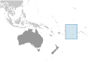 Named after Captain COOK, who sighted them in 1770, the islands became a British protectorate in 1888. By 1900, administrative control was transferred to New Zealand; in 1965, residents chose self-government in free association with New Zealand. The emigration of skilled workers to New Zealand and government deficits are continuing problems.